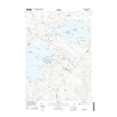
2015 Map of Wolfeboro
USGS Topo · Published 2015About this map
Wolfeboro serves as the focal point of this 2015 study, situated at the confluence of Lake Winnipesaukee and the smaller Crescent Lake. This area, widely recognized for its lakefront geography, is meticulously detailed from the clustered streets of Wolfeboro Falls to the quieter reaches of South Wolfeboro. The map illustrates the region's recreational and community character, showing the locations of the Wolfeboro Town Beach and the extensive archipelago within Lake Wentworth, including Stamp Act Island and the Seven Sisters Islands.
Find a feature on this map
214 named features on this map. Tap any name to fly to it.
Don’t see what you’re looking for? This feature index may not catch every label — zoom into the map to look around manually.
Map Details
Editions of this 2015 Wolfeboro Map
This is the sole edition of this map. No revisions or reprints were ever made.
Other maps of this area

1909 · Winnepesaukee
USGS Topo · 1:62,500

1919 · Gilmanton
USGS Topo · 1:62,500

1919 · Alton
USGS Topo · 1:62,500

1927 · Gilmanton
USGS Topo · 1:62,500

1928 · Wolfeboro
USGS Topo · 1:62,500

1949 · Portland
USGS Topo · 1:250,000

1956 · Winnipesaukee
USGS Topo · 1:62,500

1956 · Portland
USGS Topo · 1:250,000

1957 · Alton
USGS Topo · 1:62,500
1957 · Gilmanton
USGS Topo · 1:62,500