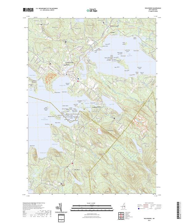
2024 Map of Wolfeboro
USGS Topo · Published 2024About this map
Lake Winnipesaukee and Lake Wentworth dominate this Carroll County landscape, creating a complex geography of points, basins, and islands that have long shaped the region's development. The shoreline is densely punctuated by named features like Wolfeboro Bay, Jockey Cove, and Winter Harbor, reflecting the area's deep history as a lakeside destination. Further inland, the map shows the transition from waterfront activity to the structured settlements of Wolfeboro Falls, South Wolfeboro, and Wolfeboro Center.
Find a feature on this map
228 named features on this map. Tap any name to fly to it.
Don’t see what you’re looking for? This feature index may not catch every label — zoom into the map to look around manually.
Map Details
Editions of this 2024 Wolfeboro Map
This is the sole edition of this map. No revisions or reprints were ever made.
Other maps of this area

1909 · Winnepesaukee
USGS Topo · 1:62,500

1919 · Gilmanton
USGS Topo · 1:62,500

1919 · Alton
USGS Topo · 1:62,500

1927 · Gilmanton
USGS Topo · 1:62,500

1928 · Wolfeboro
USGS Topo · 1:62,500

1949 · Portland
USGS Topo · 1:250,000

1956 · Winnipesaukee
USGS Topo · 1:62,500

1956 · Portland
USGS Topo · 1:250,000

1957 · Alton
USGS Topo · 1:62,500
1957 · Gilmanton
USGS Topo · 1:62,500