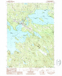
1987 Map of Wolfeboro
USGS Topo · Published 1987About this map
Wolfeboro sits at the nexus of New Hampshire's lake country, positioned between the eastern shores of Lake Winnipesaukee and the waters of Lake Wentworth. The landscape is defined by its complex shorelines, featuring Wolfeboro Neck and prominent islands like Stamp Act Island and Barndoor Island. This 1987 edition shows the region's character as a established recreational and residential destination, with the Golf Course and Wentworth State Park punctuating the wooded hills.
Find a feature on this map
78 named features on this map. Tap any name to fly to it.
Don’t see what you’re looking for? This feature index may not catch every label — zoom into the map to look around manually.
Map Details
Editions of this 1987 Wolfeboro Map
This is the sole edition of this map. No revisions or reprints were ever made.
Other maps of this area

1909 · Winnepesaukee
USGS Topo · 1:62,500

1919 · Gilmanton
USGS Topo · 1:62,500

1919 · Alton
USGS Topo · 1:62,500

1927 · Gilmanton
USGS Topo · 1:62,500

1928 · Wolfeboro
USGS Topo · 1:62,500

1949 · Portland
USGS Topo · 1:250,000

1956 · Winnipesaukee
USGS Topo · 1:62,500

1956 · Portland
USGS Topo · 1:250,000

1957 · Alton
USGS Topo · 1:62,500
1957 · Gilmanton
USGS Topo · 1:62,500