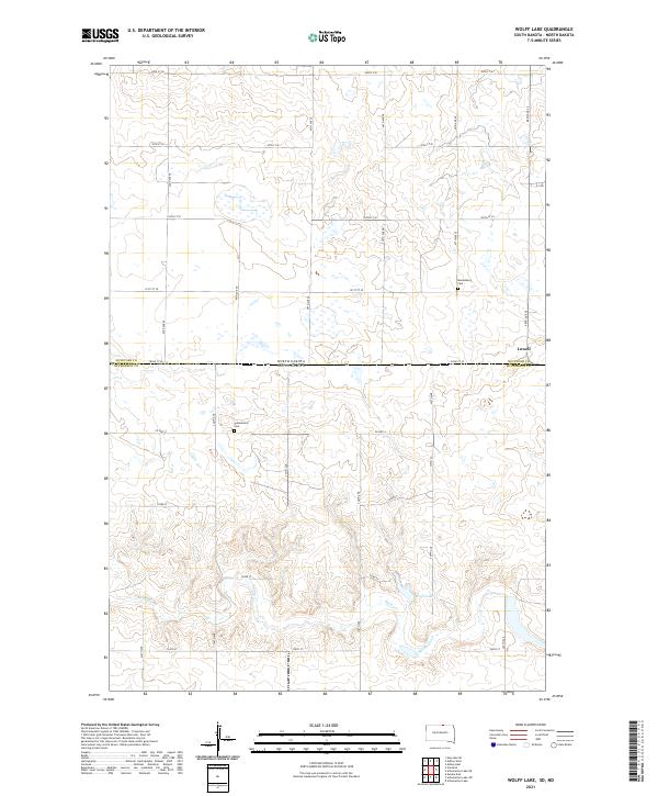
2021 Map of Wolff Lake
USGS Topo · Published 2021About this map
The state boundary between McIntosh County, North Dakota and McPherson County, South Dakota bisects this prairie landscape, where straight-line section roads define a grid across the glaciated terrain. To the south, the drainage of Spring Creek (also labeled Spring Cr) snakes through the hills, eventually feeding into the namesake Wolff Lake. The map reveals the quiet infrastructure of agricultural life, from the small settlement of Lowell on the eastern edge to the scattered burial grounds that speak to the area's pioneer heritage. Local history is anchored by the Johannestal Cem and Marienburg Cem, which serve as permanent markers for early families who settled these sections. The transition from the more developed road network north of the state line, featuring named streets like 98th St SE, to the southern routes like Co Hwy 4, illustrates the subtle differences in local infrastructure across the two states.
Find a feature on this map
32 named features on this map. Tap any name to fly to it.
Don’t see what you’re looking for? This feature index may not catch every label — zoom into the map to look around manually.
Map Details
Editions of this 2021 Wolff Lake Map
This is the sole edition of this map. No revisions or reprints were ever made.
Other maps of this area

1953 · Jamestown
USGS Topo · 1:250,000

1954 · Aberdeen
USGS Topo · 1:250,000

1956 · Aberdeen
USGS Topo · 1:250,000

1956 · Jamestown
USGS Topo · 1:250,000

1978 · Wolff Lake
USGS Topo · 1:24,000

1978 · Venturia
USGS Topo · 1:24,000

1978 · Eureka East
USGS Topo · 1:24,000

1978 · Schumacher Lake
USGS Topo · 1:24,000

1978 · Schumacher Lake SW
USGS Topo · 1:24,000

1978 · Schumacher Lake NE
USGS Topo · 1:24,000