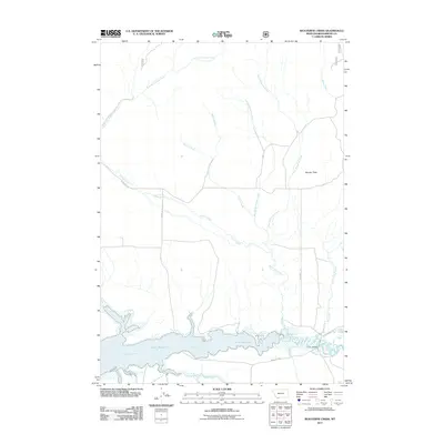
2011 Map of Wolverine Creek
USGS Topo · Published 2011About this map
The Lima Reservoir and the Red Rock River dominate this southern Beaverhead County landscape, where the high-altitude drainage systems of the Centennial Valley converge. This mapping captures the complex network of mountain runoff fed by First Wolverine Creek, Second Wolverine Creek, and Sandy Creek as they descend toward the reservoir. The map reveals the pastoral and ranching character of the region through naming conventions such as Whiskey Row and Matador Ln, reflecting the enduring land use patterns in this part of Montana.
Find a feature on this map
18 named features on this map. Tap any name to fly to it.
Don’t see what you’re looking for? This feature index may not catch every label — zoom into the map to look around manually.
Map Details
Editions of this 2011 Wolverine Creek Map
This is the sole edition of this map. No revisions or reprints were ever made.
Other maps of this area

1955 · Dubois
USGS Topo · 1:250,000

1958 · Dubois
USGS Topo · 1:250,000

1968 · Stonehouse Mountain
USGS Topo · 1:24,000

1968 · Corral Creek
USGS Topo · 1:24,000

1968 · Big Table Mountain
USGS Topo · 1:24,000

1968 · Whiskey Spring
USGS Topo · 1:24,000

1968 · Lima Dam
USGS Topo · 1:24,000

1968 · Antelope Peak
USGS Topo · 1:24,000

1968 · Monida
USGS Topo · 1:24,000

1968 · Antone Peak
USGS Topo · 1:24,000