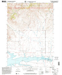
1997 Map of Wolverine Creek
USGS Topo · Published 2002About this map
Beaverhead National Forest defines the northern reaches of this landscape, where the terrain drops from the high slopes of the forest into the broad expanse of the Centennial Valley. The southern portion of the sheet is dominated by the waters of the Lima Reservoir, a significant catchment fed by the Red Rock River. The hydrologic network here is intricate, with numerous drainage systems such as Clover Fork, Sandy Creek, and Wolverine Creek carving through the foothills toward the valley floor.
Find a feature on this map
18 named features on this map. Tap any name to fly to it.
Don’t see what you’re looking for? This feature index may not catch every label — zoom into the map to look around manually.
Map Details
Editions of this 1997 Wolverine Creek Map
This is the sole edition of this map. No revisions or reprints were ever made.
Other maps of this area

1955 · Dubois
USGS Topo · 1:250,000

1958 · Dubois
USGS Topo · 1:250,000

1968 · Stonehouse Mountain
USGS Topo · 1:24,000

1968 · Corral Creek
USGS Topo · 1:24,000

1968 · Big Table Mountain
USGS Topo · 1:24,000

1968 · Whiskey Spring
USGS Topo · 1:24,000

1968 · Lima Dam
USGS Topo · 1:24,000

1968 · Antelope Peak
USGS Topo · 1:24,000

1968 · Monida
USGS Topo · 1:24,000

1968 · Antone Peak
USGS Topo · 1:24,000