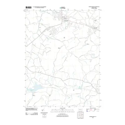
2010 Map of Womelsdorf
USGS Topo · Published 2010About this map
Womelsdorf and Robesonia anchor the northern landscape of this Berks and Lancaster County border region, where agricultural valleys meet the rise of South Mountain. The area is defined by its deep roots, visible in the United Evangelical Church and the expansive Womelsdorf Union Cemetery. Further south, the terrain shifts into the wooded hills of Eagle Peak and Kline Hill, where recreational and water-management features like Furnace Hills Camp and the Middle Creek Reservoir occupy the landscape.
Find a feature on this map
86 named features on this map. Tap any name to fly to it.
Don’t see what you’re looking for? This feature index may not catch every label — zoom into the map to look around manually.
Map Details
Editions of this 2010 Womelsdorf Map
This is the sole edition of this map. No revisions or reprints were ever made.
Other maps of this area

1891 · Lebanon
USGS Topo · 1:62,500

1893 · Lebanon
USGS Topo · 1:62,500

1899 · Lebanon
USGS Topo · 1:62,500

1902 · Wernersville
USGS Topo · 1:62,500

1902 · Lancaster
USGS Topo · 1:62,500

1904 · Lancaster
USGS Topo · 1:62,500

1906 · New Holland
USGS Topo · 1:62,500

1908 · New Holland
USGS Topo · 1:62,500

1941 · New Holland
USGS Topo · 1:62,500

1943 · Lancaster
USGS Topo · 1:62,500