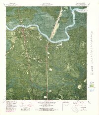
1979 Map of Woodbine
USGS Topo · Published 1988About this map
The Satilla River defines the landscape of Camden County in this late-1970s orthophotomap, winding through an intricate network of wetlands and islands. The city of Woodbine serves as the focal point, situated at a bend in the river where local landmarks like Hamilton Chapel and Madison Chapel stand near the town center. The map reveals the deep-rooted community geography of the Georgia coast, from the small settlements of Halifax and Ceylon to the various churches that dotted the rural corridors, including Gethsemane Ch and Enterprise Ch.
Find a feature on this map
58 named features on this map. Tap any name to fly to it.
Don’t see what you’re looking for? This feature index may not catch every label — zoom into the map to look around manually.
Map Details
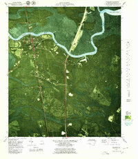
Editions of this 1979 Woodbine Map
2 editions found
Other maps of this area

1917 · Nahunta
USGS Topo · 1:62,500

1917 · Boulogne
USGS Topo · 1:62,500

1918 · Nahunta
USGS Topo · 1:62,500

1918 · Bladen
USGS Topo · 1:62,500

1918 · Kingsland
USGS Topo · 1:62,500

1919 · Boulogne
USGS Topo · 1:62,500

1939 · Bladen
USGS Topo · 1:62,500

1946 · Brunswick
USGS Topo · 1:250,000

1948 · Jacksonville
USGS Topo · 1:250,000

1948 · Brunswick
USGS Topo · 1:250,000