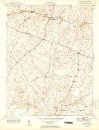
1950 Map of Woodbine
USGS Topo · Published 1950About this map
The South Branch Patapsco River serves as the dividing line between Carroll and Howard counties, with the Baltimore and Ohio railroad corridor tracking its course through the northern valley. This mid-century survey reveals a landscape of dispersed agricultural settlements and mill sites, including Roxbury Mills and Hipsleys Mill, connected by a winding network of country roads. The transition from early industrial water-power sites to established rural communities is evident in crossroads like Lisbon and Cooksville. Topographical details from aerial photography taken between 1943 and 1945 show the intricate drainage of Cattail Creek and Gillis Falls, highlighting how the undulating terrain shaped local development. Further south, the Patuxent River marks the border with Montgomery County, framing a region that remained predominantly rural prior to the suburban expansion of later decades.
Find a feature on this map
31 named features on this map. Tap any name to fly to it.
Don’t see what you’re looking for? This feature index may not catch every label — zoom into the map to look around manually.
Map Details
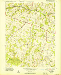
Editions of this 1950 Woodbine Map
2 editions found
Other maps of this area

1892 · Laurel
USGS Topo · 1:62,500

1892 · Ellicott
USGS Topo · 1:62,500

1893 · Frederick
USGS Topo · 1:125,000

1894 · Ellicott
USGS Topo · 1:62,500

1894 · Laurel
USGS Topo · 1:62,500

1894 · Frederick
USGS Topo · 1:125,000

1897 · Laurel
USGS Topo · 1:62,500

1906 · Ellicott
USGS Topo · 1:62,500

1907 · Laurel
USGS Topo · 1:62,500

1908 · Patapsco
USGS Topo · 1:125,000