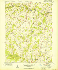
1950 Map of Woodbine
USGS Topo · Published 1950About this map
The South Branch Patapsco River and the Baltimore and Ohio railroad corridor define the northern boundary of this landscape at the intersection of Howard, Carroll, and Montgomery Counties. In the mid-1940s, when these aerial photographs were captured, the region was characterized by a dense network of small milling centers and crossroads hamlets. The prominence of family-named milling sites such as Hipsleys Mill, Roxbury Mills, Hoods Mill, and Carrs Mill speaks to the local agricultural economy and the importance of water power provided by Cattail Creek and the Patuxent River.
Find a feature on this map
29 named features on this map. Tap any name to fly to it.
Don’t see what you’re looking for? This feature index may not catch every label — zoom into the map to look around manually.
Map Details
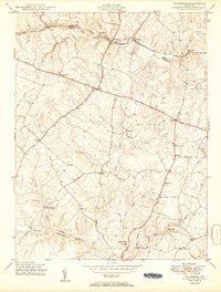
Editions of this 1950 Woodbine Map
2 editions found
Other maps of this area

1892 · Laurel
USGS Topo · 1:62,500

1892 · Ellicott
USGS Topo · 1:62,500

1893 · Frederick
USGS Topo · 1:125,000

1894 · Ellicott
USGS Topo · 1:62,500

1894 · Laurel
USGS Topo · 1:62,500

1894 · Frederick
USGS Topo · 1:125,000

1897 · Laurel
USGS Topo · 1:62,500

1906 · Ellicott
USGS Topo · 1:62,500

1907 · Laurel
USGS Topo · 1:62,500

1908 · Patapsco
USGS Topo · 1:125,000