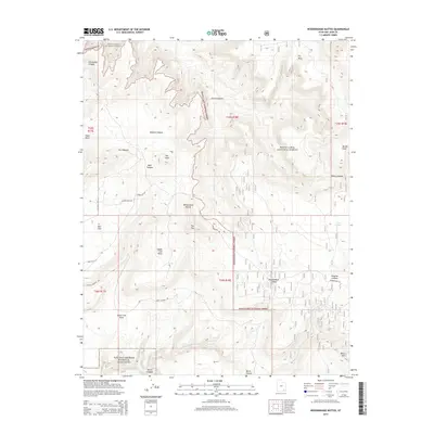
2014 Map of Woodenshoe Buttes
USGS Topo · Published 2014About this map
Natural Bridges National Monument anchors the southern boundary of this high-plateau landscape, where the waters of White Canyon Cr have carved deep into the sandstone. This 2014 survey documents a territory defined by its topographic extremes, from the distinct twin peaks of Bears Ears in the southeast to the sheer cliffs of Woodenshoe Buttes. Much of the northern and eastern reaches fall within the Manti-La Sal National Forest, a region characterized by named landforms such as The Hideout and Dry Mesa. A network of backcountry routes, including Deer Flat Rd and Woodenshoe Rd, provides access to remote drainages like Peavine Canyon and Cheesebox Canyon. The map preserves the specific nomenclature of the livestock and hunting era, seen in labels like Upper Lost Parks and Elmers Field Rd, illustrating how human activity is confined to the more accessible flats and canyon floors.
Find a feature on this map
34 named features on this map. Tap any name to fly to it.
Don’t see what you’re looking for? This feature index may not catch every label — zoom into the map to look around manually.
Map Details
Editions of this 2014 Woodenshoe Buttes Map
This is the sole edition of this map. No revisions or reprints were ever made.
Other maps of this area

1886 · Henry Mountains
USGS Topo · 1:250,000

1886 · Abajo
USGS Topo · 1:250,000

1892 · Abajo
USGS Topo · 1:250,000

1892 · Henry Mountains
USGS Topo · 1:250,000

1893 · Abajo
USGS Topo · 1:250,000

1935 · Elk Ridge
USGS Topo · 1:96,000

1940 · Elk Ridge
USGS Topo · 1:125,000

1952 · Mouth of Dark Canyon
USGS Topo · 1:62,500

1952 · Natural Bridges
USGS Topo · 1:62,500

1954 · White Canyon 4 NE
USGS Topo · 1:24,000