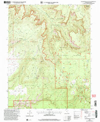
2001 Map of Woodenshoe Buttes
USGS Topo · Published 2004About this map
Woodenshoe Buttes and the deeply incised drainages of the Manti-La Sal National Forest dominate this landscape, which includes portions of the Dark Canyon Wilderness. In the early 21st century, this remote high-desert environment in San Juan County shows a network of 4WD tracks providing access to isolated landmarks such as The Hideout, The Toe, and The Heel. The map detail reveals the intersection of wilderness preservation and historical resource extraction, evidenced by scattered Corrals, Prospects, and an Adit near Woodenshoe Canyon. The southern edge of the sheet touches the Natural Bridges National Monument at White Canyon, while the northern reaches include the expansive Dry Mesa. This survey serves as a record of the area's physical geography before modern recreation pressures, marking essential water sources like Twin Springs and the distinct formation of the Bears Ears.
Find a feature on this map
40 named features on this map. Tap any name to fly to it.
Don’t see what you’re looking for? This feature index may not catch every label — zoom into the map to look around manually.
Map Details
Editions of this 2001 Woodenshoe Buttes Map
This is the sole edition of this map. No revisions or reprints were ever made.
Other maps of this area

1886 · Henry Mountains
USGS Topo · 1:250,000

1886 · Abajo
USGS Topo · 1:250,000

1892 · Abajo
USGS Topo · 1:250,000

1892 · Henry Mountains
USGS Topo · 1:250,000

1893 · Abajo
USGS Topo · 1:250,000

1935 · Elk Ridge
USGS Topo · 1:96,000

1940 · Elk Ridge
USGS Topo · 1:125,000

1952 · Mouth of Dark Canyon
USGS Topo · 1:62,500

1952 · Natural Bridges
USGS Topo · 1:62,500

1954 · White Canyon 4 NE
USGS Topo · 1:24,000