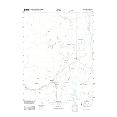
2012 Map of Woodfords
USGS Topo · Published 2012About this map
The W Fork Carson River carves a central path through this terrain, where the high Sierra slopes meet the valley floor. Settlement is clustered around historic junctions like Woodfords and Alpine Village, reflecting a landscape defined by water rights and mountain passage. The infrastructure of the early West is visible in the extensive irrigation network, including the Fredericksburg Ditch, Falke and Tillman Ditch, and Millich Ditch, which directed mountain runoff to the arid flats.
Find a feature on this map
54 named features on this map. Tap any name to fly to it.
Don’t see what you’re looking for? This feature index may not catch every label — zoom into the map to look around manually.
Map Details
Editions of this 2012 Woodfords Map
This is the sole edition of this map. No revisions or reprints were ever made.
Other maps of this area

1889 · Markleeville
USGS Topo · 1:125,000

1891 · Markleeville
USGS Topo · 1:125,000

1893 · Markleeville
USGS Topo · 1:125,000

1948 · Walker Lake
USGS Topo · 1:250,000
1955 · Freel Peak
USGS Topo · 1:24,000

1955 · Bijou
USGS Topo · 1:24,000

1956 · Freel Peak
USGS Topo · 1:62,500

1956 · Topaz Lake
USGS Topo · 1:62,500

1956 · Markleeville
USGS Topo · 1:62,500

1957 · Walker Lake
USGS Topo · 1:250,000