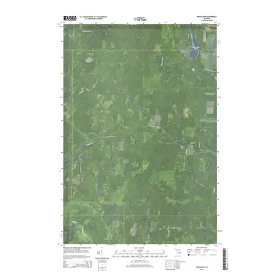
2014 Map of Woodlawn
USGS Topo · Published 2014About this map
The Ford River and Escanaba River systems converge in this area of Michigan’s Upper Peninsula, where the border of Delta, Menominee, and Marquette counties meet. This 2014 survey captures the rural landscape defined by small settlements like Woodlawn and Hendricks connected by a network of county roads such as Cedardale 28th Rd and CR-426. The hydrography is notably complex, featuring the Boney Falls Basin on the Escanaba and the natural drop at Rose Falls (West). Inland, the terrain is marked by smaller watercourses like Hunters Brook and Twentyfour Mile Cr, alongside Burton Lake. Settlement patterns remain sparse, with the community of Kingsley appearing near the eastern edge, illustrating the enduring woodland character of this tri-county border region.
Find a feature on this map
28 named features on this map. Tap any name to fly to it.
Don’t see what you’re looking for? This feature index may not catch every label — zoom into the map to look around manually.
Map Details
Editions of this 2014 Woodlawn Map
This is the sole edition of this map. No revisions or reprints were ever made.
Other maps of this area

1932 · Rock SW
USGS Topo · 1:31,680

1932 · Whitney NE
USGS Topo · 1:31,680

1932 · Whitney SE
USGS Topo · 1:31,680

1932 · Helena SW
USGS Topo · 1:31,680

1932 · Gladstone SW
USGS Topo · 1:31,680

1932 · Helena
USGS Topo · 1:31,680

1932 · Gladstone NW
USGS Topo · 1:31,680

1950 · Gladstone NW
USGS Topo · 1:31,680

1951 · Helena SW
USGS Topo · 1:31,680

1951 · Helena
USGS Topo · 1:31,680