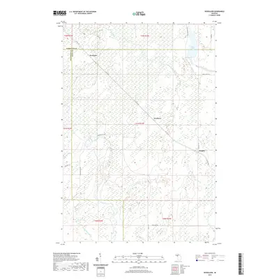
2019 Map of Woodlawn
USGS Topo · Published 2019About this map
The Escanaba River and Ford River define this portion of the Upper Peninsula, cutting through a landscape of wetlands and northern forests. Near the Boney Falls Basin, the river geography includes Rice Falls (West), illustrating the water-driven character of the region. Small settlements like Woodlawn, Hendricks, and Kingsley are scattered along a network of county roads, such as Co 426 E RD, which served as primary connectors through the backcountry. This 2019 data illustrates the enduring rural patterns of the area, where water bodies like Burton Lake and tributaries like Twentyfour Mile Cr remain central to the local geography. The map also records several local routes including Finn Dad TRL and Cedardale 28th RD, which provide access to the interior reaches of Menominee, Delta, and Marquette counties.
Find a feature on this map
29 named features on this map. Tap any name to fly to it.
Don’t see what you’re looking for? This feature index may not catch every label — zoom into the map to look around manually.
Map Details
Editions of this 2019 Woodlawn Map
This is the sole edition of this map. No revisions or reprints were ever made.
Other maps of this area

1932 · Rock SW
USGS Topo · 1:31,680

1932 · Whitney NE
USGS Topo · 1:31,680

1932 · Whitney SE
USGS Topo · 1:31,680

1932 · Helena SW
USGS Topo · 1:31,680

1932 · Gladstone SW
USGS Topo · 1:31,680

1932 · Helena
USGS Topo · 1:31,680

1932 · Gladstone NW
USGS Topo · 1:31,680

1950 · Gladstone NW
USGS Topo · 1:31,680

1951 · Helena SW
USGS Topo · 1:31,680

1951 · Helena
USGS Topo · 1:31,680