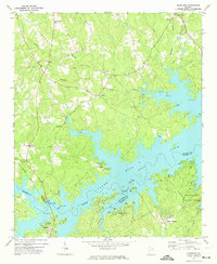
1971 Map of Woodlawn
USGS Topo · Published 1974About this map
Clark Hill Lake dominates the central and eastern portions of this 1971 survey, showing a landscape defined by the impoundment of the Little River. This reservoir has reshaped the local geography where Lincoln and Columbia counties meet, creating an intricate shoreline of inlets and points now utilized for recreation at Mistletoe State Park and various boat ramps. Inland, the map documents a network of rural settlements and spiritual centers that predate the reservoir's full development.
Find a feature on this map
34 named features on this map. Tap any name to fly to it.
Don’t see what you’re looking for? This feature index may not catch every label — zoom into the map to look around manually.
Map Details
Editions of this 1971 Woodlawn Map
This is the sole edition of this map. No revisions or reprints were ever made.
Other maps of this area

1892 · Mc Cormick
USGS Topo · 1:125,000

1906 · Crawfordville
USGS Topo · 1:125,000

1912 · Mc Cormick
USGS Topo · 1:125,000

1921 · Appling
USGS Topo · 1:62,500

1943 · Appling
USGS Topo · 1:62,500

1953 · Athens
USGS Topo · 1:250,000

1954 · Metasville
USGS Topo · 1:24,000

1958 · Athens
USGS Topo · 1:250,000

1959 · Athens
USGS Topo · 1:250,000

1963 · Athens
USGS Topo · 1:250,000