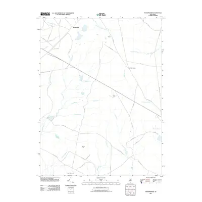
2011 Map of Woodmansie
USGS Topo · Published 2011About this map
Woodmansie and the surrounding Pine Barrens landscape are documented here during the early 21st century, revealing a sparse settlement pattern defined by isolated communities like Old Halfway and Red Oak Grove. The terrain is characterized by an intricate network of watercourses, including South Branch Mount Misery Brook and the Sykes Branch, alongside notable high points such as Spring Hill and Bear Swamp Hill.
Find a feature on this map
55 named features on this map. Tap any name to fly to it.
Don’t see what you’re looking for? This feature index may not catch every label — zoom into the map to look around manually.
Map Details
Editions of this 2011 Woodmansie Map
This is the sole edition of this map. No revisions or reprints were ever made.
Other maps of this area

1884 · Whitings
USGS Topo · 1:62,500

1888 · Pemberton
USGS Topo · 1:62,500

1888 · Little Egg Harbor
USGS Topo · 1:62,500

1888 · Whitings
USGS Topo · 1:62,500

1890 · Mullica
USGS Topo · 1:62,500

1893 · Little Egg Harbor
USGS Topo · 1:62,500

1894 · Pemberton
USGS Topo · 1:62,500

1894 · Mullica
USGS Topo · 1:62,500

1898 · Pemberton
USGS Topo · 1:62,500

1898 · Mullica
USGS Topo · 1:62,500
Featured Places
- Manchester Township, NJ
- Stafford Township, NJ
- Lacey Township, NJ
- Barnegat Township, NJ
- Little Egg Harbor Township, NJ