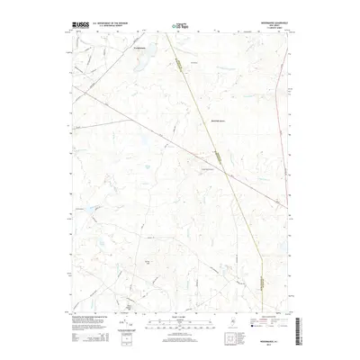
2014 Map of Woodmansie
USGS Topo · Published 2014About this map
Woodmansie and the surrounding Pine Barrens are defined by an intricate network of narrow streams and small ponds, marking a landscape where water and terrain dictate the layout of roads. The county line between Ocean County and Burlington County cuts diagonally through the territory, passing near the small settlements of Old Halfway and Red Oak Grove. The local infrastructure is dominated by the sprawling footprint of Coyle Field Airport and the corridor of Route 72, which provides one of the few paved arteries through the dense woodlands. Historical routes such as Long Causeway and Laurie's Road crisscross the area, while topographic features like Spring Hill and Bear Swamp Hill rise above the wetlands and branches of the South Branch Mount Misery Brook.
Find a feature on this map
53 named features on this map. Tap any name to fly to it.
Don’t see what you’re looking for? This feature index may not catch every label — zoom into the map to look around manually.
Map Details
Editions of this 2014 Woodmansie Map
This is the sole edition of this map. No revisions or reprints were ever made.
Other maps of this area

1884 · Whitings
USGS Topo · 1:62,500

1888 · Pemberton
USGS Topo · 1:62,500

1888 · Little Egg Harbor
USGS Topo · 1:62,500

1888 · Whitings
USGS Topo · 1:62,500

1890 · Mullica
USGS Topo · 1:62,500

1893 · Little Egg Harbor
USGS Topo · 1:62,500

1894 · Pemberton
USGS Topo · 1:62,500

1894 · Mullica
USGS Topo · 1:62,500

1898 · Pemberton
USGS Topo · 1:62,500

1898 · Mullica
USGS Topo · 1:62,500
Featured Places
- Manchester Township, NJ
- Stafford Township, NJ
- Lacey Township, NJ
- Barnegat Township, NJ
- Little Egg Harbor Township, NJ