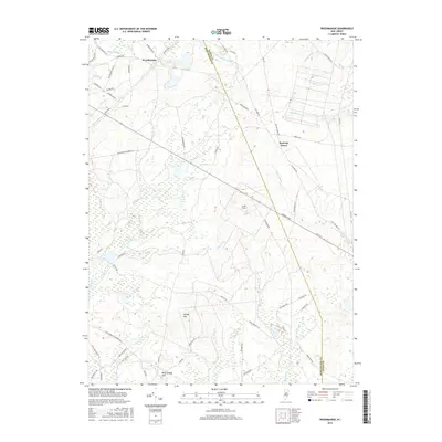
2016 Map of Woodmansie
USGS Topo · Published 2016About this map
Woodmansie serves as the focal point for this 2016 survey of the New Jersey Pine Barrens, a landscape defined by an intricate network of waterways and low-lying wetlands. The boundary between Burlington Co and Ocean Co bisects the area, crossing through the aviation facilities at Coyle Field. To the south, Bear Swamp Hill rises above a terrain woven with numerous tributaries including Shreve Br, Shoal Branch, and Breeches Br. Smaller settlements such as Red Oak Grove and Spring Hill are connected by a web of local routes like Clay Mine Rd and Barnegat Rd, which highlight the historical significance of natural resource extraction and transit in this region. The map details localized water features such as Decou Pond and Goose Pond, alongside smaller branches like Chamberlain Br and Yellow Dam Br that feed into the larger Pinelands ecosystem.
Find a feature on this map
67 named features on this map. Tap any name to fly to it.
Don’t see what you’re looking for? This feature index may not catch every label — zoom into the map to look around manually.
Map Details
Editions of this 2016 Woodmansie Map
This is the sole edition of this map. No revisions or reprints were ever made.
Other maps of this area

1884 · Whitings
USGS Topo · 1:62,500

1888 · Pemberton
USGS Topo · 1:62,500

1888 · Little Egg Harbor
USGS Topo · 1:62,500

1888 · Whitings
USGS Topo · 1:62,500

1890 · Mullica
USGS Topo · 1:62,500

1893 · Little Egg Harbor
USGS Topo · 1:62,500

1894 · Pemberton
USGS Topo · 1:62,500

1894 · Mullica
USGS Topo · 1:62,500

1898 · Pemberton
USGS Topo · 1:62,500

1898 · Mullica
USGS Topo · 1:62,500
Featured Places
- Manchester Township, NJ
- Stafford Township, NJ
- Lacey Township, NJ
- Barnegat Township, NJ
- Little Egg Harbor Township, NJ