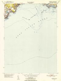
1951 Map of Woodmont
USGS Topo · Published 1952About this map
The shoreline of Long Island Sound dominates this early 1950s survey, capturing the coastal development of West Haven and East Haven. Dense residential patterns are visible at West Shore and Woodmont, where the street grid presses right against the rocky waterfront. Significant maritime infrastructure is detailed, including the New Haven Lighthouse and the Southwest Ledge Lighthouse, alongside the extensive Breakwater systems that shield the harbor approach.
Find a feature on this map
32 named features on this map. Tap any name to fly to it.
Don’t see what you’re looking for? This feature index may not catch every label — zoom into the map to look around manually.
Map Details
Editions of this 1951 Woodmont Map
2 editions found
Other maps of this area

1889 · Derby
USGS Topo · 1:62,500

1891 · Bridgeport
USGS Topo · 1:62,500

1891 · Derby
USGS Topo · 1:62,500

1892 · New Haven
USGS Topo · 1:62,500

1893 · Bridgeport
USGS Topo · 1:62,500

1893 · Derby
USGS Topo · 1:62,500

1920 · Bridgeport
USGS Topo · 1:62,500

1921 · New Haven
USGS Topo · 1:62,500

1943 · New Haven
USGS Topo · 1:31,680

1947 · Hartford
USGS Topo · 1:250,000