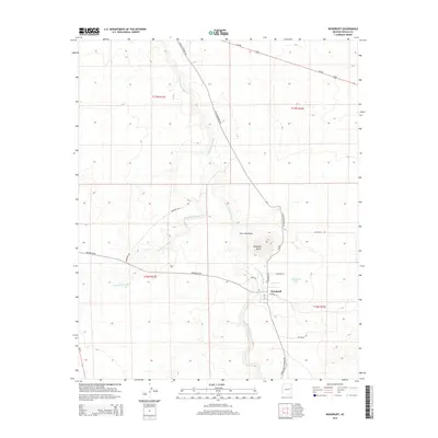
2014 Map of Woodruff
USGS Topo · Published 2014About this map
Woodruff occupies a central position along the Little Colorado River in this arid Navajo County landscape, where the seasonal hydrology of Washboard Wash and Carr Lake Draw shapes the terrain. The community is defined by its relationship with the river, which feeds the nearby Woodruff Lake to the east. Historically significant transport routes such as N Old Woodruff Rd and Snowflake-Woodruff Rd converge here, alongside local thoroughfares like Jacamar Ln and Bluebird Ln. Notable landmarks include Woodruff Butte, which rises as a prominent topographical feature north of the settlement. The map also identifies Pottsville to the south, providing a record of smaller named localities and rural road networks including Old Ranch Rd and Woodruff Rd that facilitated movement through the high desert of eastern Arizona during this period.
Find a feature on this map
21 named features on this map. Tap any name to fly to it.
Don’t see what you’re looking for? This feature index may not catch every label — zoom into the map to look around manually.
Map Details
Editions of this 2014 Woodruff Map
This is the sole edition of this map. No revisions or reprints were ever made.
Other maps of this area

1886 · St Johns
USGS Topo · 1:250,000

1886 · Holbrook
USGS Topo · 1:250,000

1892 · St Johns
USGS Topo · 1:250,000

1893 · Holbrook
USGS Topo · 1:250,000

1912 · Petrified Forest
USGS Topo · 1:62,500

1954 · Holbrook
USGS Topo · 1:250,000

1954 · Saint Johns
USGS Topo · 1:250,000

1955 · Petrified Forest
USGS Topo · 1:62,500

1955 · St. Joseph 1 NE
USGS Topo · 1:24,000

1955 · St. Joseph 1 SE
USGS Topo · 1:24,000