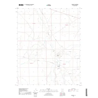
2018 Map of Woodruff
USGS Topo · Published 2018About this map
Woodruff sits at the heart of this high-desert landscape in Navajo County, where the Little Colorado River carves a winding path through the arid terrain. The settlement is positioned near a bend in the river, supported by water features like Woodruff Lake and the drainage of Carr Lake Draw. The topography is defined by significant elevations such as Woodruff Butte, which overlooks the intersection of local routes and the river valley. The map reveals a network of rural corridors including Woodruff Rd and Woodruff-180 Rd, connecting the town to the surrounding rangeland. Historically significant local naming is evident in thoroughfares like Wengert Ranch Rd and Old Ranch Rd, reflecting the area's agricultural and ranching heritage. Long drainage systems like Washboard Wash illustrate the complex hydrology of the region, where seasonal water flow has sculpted the basin's floor over time.
Find a feature on this map
21 named features on this map. Tap any name to fly to it.
Don’t see what you’re looking for? This feature index may not catch every label — zoom into the map to look around manually.
Map Details
Editions of this 2018 Woodruff Map
This is the sole edition of this map. No revisions or reprints were ever made.
Other maps of this area

1886 · St Johns
USGS Topo · 1:250,000

1886 · Holbrook
USGS Topo · 1:250,000

1892 · St Johns
USGS Topo · 1:250,000

1893 · Holbrook
USGS Topo · 1:250,000

1912 · Petrified Forest
USGS Topo · 1:62,500

1954 · Holbrook
USGS Topo · 1:250,000

1954 · Saint Johns
USGS Topo · 1:250,000

1955 · Petrified Forest
USGS Topo · 1:62,500

1955 · St. Joseph 1 NE
USGS Topo · 1:24,000

1955 · St. Joseph 1 SE
USGS Topo · 1:24,000