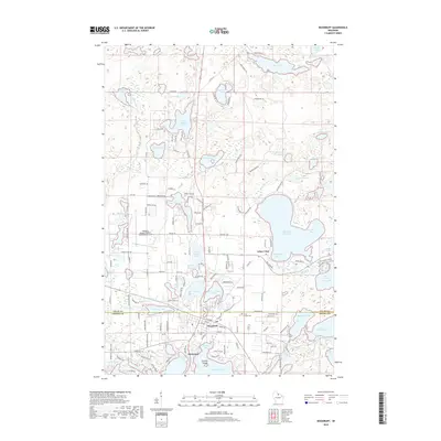
2018 Map of Woodruff
USGS Topo · Published 2018About this map
Woodruff and Minocqua serve as the primary hubs in this lake-dense region of the Northwoods, where the boundary of Vilas Co and Oneida Co bisects a landscape defined by glacial water bodies. The late 20th and early 21st-century development is visible through the intricate network of local roads and recreational trails, including the Snowmobile Trl and various drives named for the surrounding timber. Major water bodies like Big Arbor Vitae Lake and Minocqua Lake dominate the geography, featuring distinct landings such as Lucia Bay and Schoolhouse Bay.
Find a feature on this map
128 named features on this map. Tap any name to fly to it.
Don’t see what you’re looking for? This feature index may not catch every label — zoom into the map to look around manually.
Map Details
Editions of this 2018 Woodruff Map
This is the sole edition of this map. No revisions or reprints were ever made.
Other maps of this area

1938 · Minocqua
USGS Topo · 1:48,000

1938 · Lac Du Flambeau
USGS Topo · 1:48,000

1939 · Trout Lake
USGS Topo · 1:48,000

1939 · Lac Du Flambeau
USGS Topo · 1:48,000

1939 · Winchester
USGS Topo · 1:48,000

1946 · Winchester
USGS Topo · 1:48,000

1946 · Minocqua
USGS Topo · 1:48,000

1946 · Lac Du Flambeau
USGS Topo · 1:48,000

1946 · Trout Lake
USGS Topo · 1:48,000

1949 · Trout Lake
USGS Topo · 1:48,000