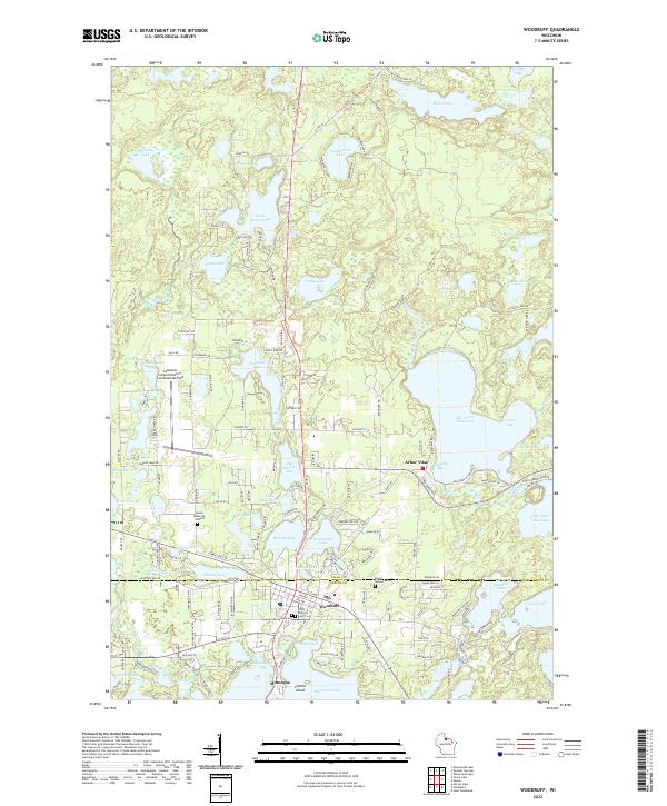
2022 Map of Woodruff
USGS Topo · Published 2022About this map
Arbor Vitae and Woodruff sit at the center of this 2022 survey, illustrating the dense concentration of glacial lakes that defines this portion of the Wisconsin Northwoods. The map details a complex landscape where residential development and recreational infrastructure, such as the Lakeland Airport/Noble F Lee Memorial Field, are closely integrated with extensive water bodies. Significant local history is preserved in several burial grounds, including Evergreen Cem and Saint Patricks Cem, providing researchers with key genealogical anchors. Large lakes like Big Arbor Vitae Lake and Little Spider Lake dominate the terrain, while smaller features like Schoolhouse Bay on the edge of the Vilas Co and Oneida Co border highlight the specific nomenclature of the region's shoreline communities.
Find a feature on this map
105 named features on this map. Tap any name to fly to it.
Don’t see what you’re looking for? This feature index may not catch every label — zoom into the map to look around manually.
Map Details
Editions of this 2022 Woodruff Map
This is the sole edition of this map. No revisions or reprints were ever made.
Other maps of this area

1938 · Minocqua
USGS Topo · 1:48,000

1938 · Lac Du Flambeau
USGS Topo · 1:48,000

1939 · Trout Lake
USGS Topo · 1:48,000

1939 · Lac Du Flambeau
USGS Topo · 1:48,000

1939 · Winchester
USGS Topo · 1:48,000

1946 · Winchester
USGS Topo · 1:48,000

1946 · Minocqua
USGS Topo · 1:48,000

1946 · Lac Du Flambeau
USGS Topo · 1:48,000

1946 · Trout Lake
USGS Topo · 1:48,000

1949 · Trout Lake
USGS Topo · 1:48,000