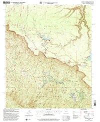
1998 Map of Woods Canyon
USGS Topo · Published 2001About this map
The Mogollon Rim escarpment dominates this landscape, serving as a massive geological boundary between the Sitgreaves National Forest to the north and the Tonto National Forest to the south. Along this dramatic drop-off, the Mogollon Rim Visitor Center and Rim Lakes Vista provide vantage points over the heavily dissected terrain below. The map captures a high-country recreation hub centered on Woods Canyon Lake and Willow Springs Lake, featuring established infrastructure like the Woods Canyon Dam and an RV Pump Station. Historical transit routes are evident in the General George Crook Road, while modern land use is represented by the residential pockets of Colcord Estates and Ponderosa Estates. Water management is prominent through various reservoirs and smaller bodies like Palomino Lake and Lake One, essential for this arid mountain environment.
Find a feature on this map
51 named features on this map. Tap any name to fly to it.
Don’t see what you’re looking for? This feature index may not catch every label — zoom into the map to look around manually.
Map Details
Editions of this 1998 Woods Canyon Map
This is the sole edition of this map. No revisions or reprints were ever made.
Other maps of this area

1886 · Holbrook
USGS Topo · 1:250,000

1887 · Verde
USGS Topo · 1:250,000

1892 · Verde
USGS Topo · 1:250,000

1893 · Holbrook
USGS Topo · 1:250,000

1934 · Promontory Butte
USGS Topo · 1:62,500

1937 · Diamond Butte
USGS Topo · 1:48,000

1939 · Promontory Butte
USGS Topo · 1:62,500

1943 · Diamond Butte
USGS Topo · 1:62,500

1952 · Promontory Butte
USGS Topo · 1:62,500

1954 · Holbrook
USGS Topo · 1:250,000
Featured Places
- Colcord Mountain Estates, AZ
- Ponderosa Spring Subdivision, AZ
- Sleepy Hollow, AZ
- Coconino County, AZ
- Gila County, AZ