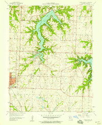
1957 Map of Woods Chapel
USGS Topo · Published 1958About this map
Lake Jac K Son and Prairie Lee Lake dominate the central landscape of this Jackson County survey, illustrating the mid-century development of water resources and recreation east of Kansas City. The northern reach of Lees Summit shows a growing suburban grid, marked by institutional anchors like St Marys Sch and the local Jr High Sch. To the east, the sprawling fingers of Lake Lotawana reach into the quadrangle, including Big Rock Bay and Buffalo Cove, which were already becoming established residential and leisure destinations.
Find a feature on this map
34 named features on this map. Tap any name to fly to it.
Don’t see what you’re looking for? This feature index may not catch every label — zoom into the map to look around manually.
Map Details
Editions of this 1957 Woods Chapel Map
This is the sole edition of this map. No revisions or reprints were ever made.
Other maps of this area

1887 · Harrisonville
USGS Topo · 1:125,000

1892 · Harrisonville
USGS Topo · 1:125,000

1894 · Harrisonville
USGS Topo · 1:125,000

1894 · Independence
USGS Topo · 1:125,000

1933 · Blue Springs
USGS Topo · 1:24,000

1934 · Oak Grove
USGS Topo · 1:24,000

1934 · Independence
USGS Topo · 1:24,000

1934 · Lees Summit
USGS Topo · 1:24,000

1934 · Woods Chapel
USGS Topo · 1:24,000

1935 · Tarsney
USGS Topo · 1:24,000