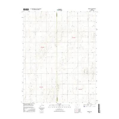
2015 Map of Woods SE
USGS Topo · Published 2015About this map
The border of Stevens Co and Seward Co defines the central axis of this High Plains landscape in southwest Kansas. The terrain is a structured grid of agricultural section lines and rural thoroughfares, illustrating the late-modern development of the region's ranching and farming infrastructure. While much of the area is partitioned by lettered and numbered routes like H Rd and Co Rd 2 N, more uniquely named corridors such as Wide Awake Ln and Jane Ann Ln appear in the eastern reaches. The map captures the precision of the Public Land Survey System, with townships like t34s r34w and t35s r35w clearly delineated. This 2015 survey reflects a landscape where the traditional section-line road network remains the primary signature of human organization across the prairie.
Find a feature on this map
37 named features on this map. Tap any name to fly to it.
Don’t see what you’re looking for? This feature index may not catch every label — zoom into the map to look around manually.
Map Details
Editions of this 2015 Woods SE Map
This is the sole edition of this map. No revisions or reprints were ever made.
Other maps of this area

1954 · Perryton
USGS Topo · 1:250,000

1955 · Dodge City
USGS Topo · 1:250,000

1958 · Perryton
USGS Topo · 1:250,000

1958 · Dodge City
USGS Topo · 1:250,000

1959 · Dodge City
USGS Topo · 1:250,000

1967 · Hooker NW
USGS Topo · 1:24,000

1967 · Tyrone
USGS Topo · 1:24,000

1968 · Liberal NW
USGS Topo · 1:24,000

1971 · Liberal
USGS Topo · 1:24,000

1973 · Little Ponderosa
USGS Topo · 1:24,000