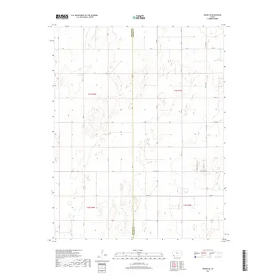
2018 Map of Woods SE
USGS Topo · Published 2018About this map
The Stevens Co Seward Co boundary line bisects this portion of the High Plains, illustrating the rigid section-line organization of the Kansas landscape. This environment is defined by its agricultural layout, where a precise grid of roads like Rd J, G Rd, and B Rd segments the terrain into productive blocks. The map reveals the localized naming conventions of the early 21st century, with thoroughfares such as Wettstein Rd and smaller, residential-named paths like Wide Awake Ln and Jane Ann Ln providing access to isolated homesteads or farm structures. Beyond the geometric precision of the township and range lines—specifically t34s r35w and t35s r34w—the topography is marked by numerous small depressions and intermittent water features typical of the region's drainage patterns.
Find a feature on this map
36 named features on this map. Tap any name to fly to it.
Don’t see what you’re looking for? This feature index may not catch every label — zoom into the map to look around manually.
Map Details
Editions of this 2018 Woods SE Map
This is the sole edition of this map. No revisions or reprints were ever made.
Other maps of this area

1954 · Perryton
USGS Topo · 1:250,000

1955 · Dodge City
USGS Topo · 1:250,000

1958 · Perryton
USGS Topo · 1:250,000

1958 · Dodge City
USGS Topo · 1:250,000

1959 · Dodge City
USGS Topo · 1:250,000

1967 · Hooker NW
USGS Topo · 1:24,000

1967 · Tyrone
USGS Topo · 1:24,000

1968 · Liberal NW
USGS Topo · 1:24,000

1971 · Liberal
USGS Topo · 1:24,000

1973 · Little Ponderosa
USGS Topo · 1:24,000