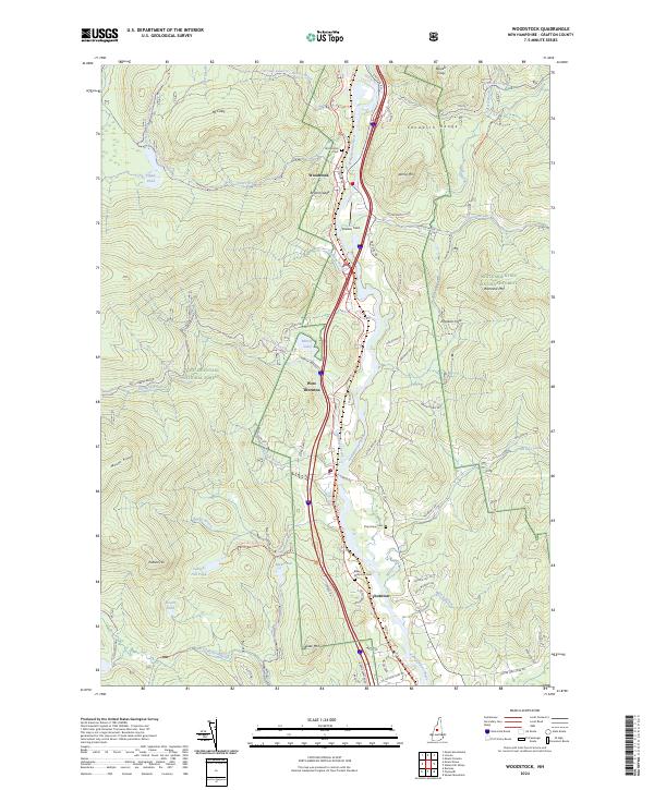
2024 Map of Woodstock
USGS Topo · Published 2024About this map
The Pemigewasset River corridor serves as the primary artery through this section of the White Mountain National Forest, where the settlements of Woodstock, West Thornton, and Thornton follow the valley floor. This 2024 survey documents a landscape where traditional transit routes have evolved, as seen in the Railroad Trl and Leemans Brook Railroad Trl—former rail lines now converted for recreational or utility use. These paths run parallel to the river and Interstate 93, marking the historical shift from steam transport to the modern highway system.
Find a feature on this map
73 named features on this map. Tap any name to fly to it.
Don’t see what you’re looking for? This feature index may not catch every label — zoom into the map to look around manually.
Map Details
Editions of this 2024 Woodstock Map
This is the sole edition of this map. No revisions or reprints were ever made.
Other maps of this area

1928 · Plymouth
USGS Topo · 1:62,500

1928 · Rumney
USGS Topo · 1:62,500

1929 · Moosilauke
USGS Topo · 1:62,500

1929 · Franconia
USGS Topo · 1:62,500

1931 · Plymouth
USGS Topo · 1:62,500

1932 · Franconia
USGS Topo · 1:62,500

1932 · Rumney
USGS Topo · 1:62,500

1932 · Moosilauke
USGS Topo · 1:62,500

1949 · Portland
USGS Topo · 1:250,000

1950 · Lewiston
USGS Topo · 1:250,000