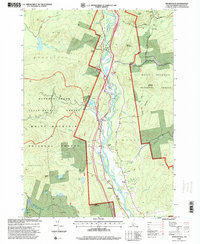
1995 Map of Woodstock
USGS Topo · Published 2000About this map
The Pemigewasset River valley forms the central corridor of this Grafton County study, where the river's path dictates the placement of the primary settlements of Woodstock, West Thornton, and Thornton. This mid-1990s documentation reveals a landscape heavily defined by its transition from managed forest research in the Hubbard Brook Experimental Forest to the public recreation and conservation of the White Mountain National Forest. Local infrastructure is well-marked along the valley floor, including the Thornton School, the Thornton Church, and a river Gaging Sta.
Find a feature on this map
53 named features on this map. Tap any name to fly to it.
Don’t see what you’re looking for? This feature index may not catch every label — zoom into the map to look around manually.
Map Details
Editions of this 1995 Woodstock Map
This is the sole edition of this map. No revisions or reprints were ever made.
Other maps of this area

1928 · Plymouth
USGS Topo · 1:62,500

1928 · Rumney
USGS Topo · 1:62,500

1929 · Moosilauke
USGS Topo · 1:62,500

1929 · Franconia
USGS Topo · 1:62,500

1931 · Plymouth
USGS Topo · 1:62,500

1932 · Franconia
USGS Topo · 1:62,500

1932 · Rumney
USGS Topo · 1:62,500

1932 · Moosilauke
USGS Topo · 1:62,500

1949 · Portland
USGS Topo · 1:250,000

1950 · Lewiston
USGS Topo · 1:250,000