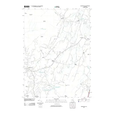
2010 Map of Woodstock
USGS Topo · Published 2010About this map
Woodstock sits at the base of the high peaks of the Catskills, where the terrain transitions from the heights of Overlook Mountain and Plattekill Mountain down toward the Hudson Valley. This 2010 survey highlights a landscape defined by its water management systems, notably the Saugerties Reservoir and a series of numbered basins including Kingston Reservoir Number One, Kingston Reservoir Number Two, and Kingston Reservoir Number Four. These reservoirs, along with the Saw Kill and Plattekill Creek, emphasize the region's importance as a watershed for nearby municipalities.
Find a feature on this map
76 named features on this map. Tap any name to fly to it.
Don’t see what you’re looking for? This feature index may not catch every label — zoom into the map to look around manually.
Map Details
Editions of this 2010 Woodstock Map
This is the sole edition of this map. No revisions or reprints were ever made.
Other maps of this area

1892 · Kaaterskill
USGS Topo · 1:62,500

1893 · Kaaterskill
USGS Topo · 1:62,500

1894 · Kaaterskill
USGS Topo · 1:62,500

1895 · Catskill
USGS Topo · 1:62,500

1898 · Rhinebeck
USGS Topo · 1:62,500

1899 · Kaaterskill
USGS Topo · 1:62,500

1901 · Rosendale
USGS Topo · 1:62,500

1903 · Rosendale
USGS Topo · 1:62,500

1903 · Kaaterskill
USGS Topo · 1:62,500

1934 · Rhinebeck
USGS Topo · 1:48,000