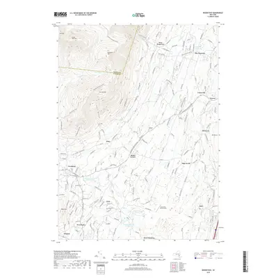
2019 Map of Woodstock
USGS Topo · Published 2019About this map
Overlook Mtn and Plattekill Mtn anchor the northwestern reaches of this region, where the terrain falls away toward a network of hamlets and reservoirs. The landscape reflects a legacy of water management for surrounding communities, evidenced by the chain of Kingston Reservoir Number One, Kingston Reservoir Number Two, and Kingston Reservoir Number Four in the south, alongside the Saugerties Reservoir to the northeast. Small settlements like Woodstock, West Saugerties, and Zena are linked by a dense web of local roads such as Platte Clove Rd and the Overlook-Turnpike Corridor. Historic sites, including the Chestnut Hill Cem and the remote Strip In the Woods Airport, suggest a pattern of development where pocketed valleys like Lewis Hollow provided secluded spaces for residential and recreational growth amidst the peaks.
Find a feature on this map
161 named features on this map. Tap any name to fly to it.
Don’t see what you’re looking for? This feature index may not catch every label — zoom into the map to look around manually.
Map Details
Editions of this 2019 Woodstock Map
This is the sole edition of this map. No revisions or reprints were ever made.
Other maps of this area

1892 · Kaaterskill
USGS Topo · 1:62,500

1893 · Kaaterskill
USGS Topo · 1:62,500

1894 · Kaaterskill
USGS Topo · 1:62,500

1895 · Catskill
USGS Topo · 1:62,500

1898 · Rhinebeck
USGS Topo · 1:62,500

1899 · Kaaterskill
USGS Topo · 1:62,500

1901 · Rosendale
USGS Topo · 1:62,500

1903 · Rosendale
USGS Topo · 1:62,500

1903 · Kaaterskill
USGS Topo · 1:62,500

1934 · Rhinebeck
USGS Topo · 1:48,000