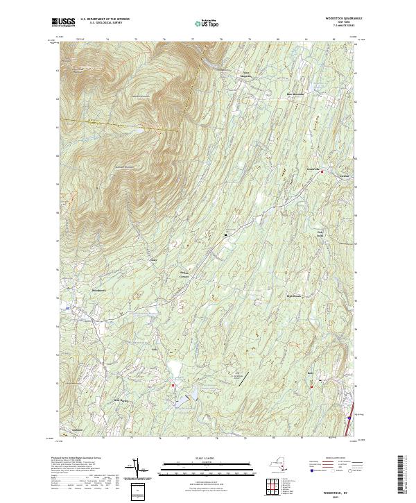
2023 Map of Woodstock
USGS Topo · Published 2023About this map
Plattekill Clove and the steep eastern escarpment of the Catskill Mountains define the topographic character of this area. The landscape transitions from the high peaks of Indian Head Mountain and Overlook Mountain down into a valley where water resources are managed through a series of significant catchments, including Kingston Reservoir Number Two, Kingston Reservoir Number One, and Kingston Reservoir Number Four. These reservoirs, along with the Saugerties Reservoir, suggest a landscape heavily engineered for regional water supply.
Find a feature on this map
42 named features on this map. Tap any name to fly to it.
Don’t see what you’re looking for? This feature index may not catch every label — zoom into the map to look around manually.
Map Details
Editions of this 2023 Woodstock Map
This is the sole edition of this map. No revisions or reprints were ever made.
Other maps of this area

1892 · Kaaterskill
USGS Topo · 1:62,500

1893 · Kaaterskill
USGS Topo · 1:62,500

1894 · Kaaterskill
USGS Topo · 1:62,500

1895 · Catskill
USGS Topo · 1:62,500

1898 · Rhinebeck
USGS Topo · 1:62,500

1899 · Kaaterskill
USGS Topo · 1:62,500

1901 · Rosendale
USGS Topo · 1:62,500

1903 · Rosendale
USGS Topo · 1:62,500

1903 · Kaaterskill
USGS Topo · 1:62,500

1934 · Rhinebeck
USGS Topo · 1:48,000