
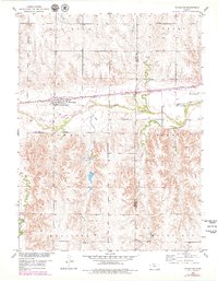
1953 Map of Woodston
USGS Topo · Published 1954About this map
Woodston serves as the primary hub of this 1950s Rooks County landscape, situated where the Missouri Pacific railroad corridor runs parallel to the South Fork Solomon River. The map reveals a highly structured rural environment, divided into named townships such as Ash Rock, Grant, and Lowell, which reflect the early administrative organization of north-central Kansas. Evidence of established local life is found at the High Sch in town and the outlying Pleasant Valley Sch.
Find a feature on this map
15 named features on this map. Tap any name to fly to it.
Don’t see what you’re looking for? This feature index may not catch every label — zoom into the map to look around manually.
Map Details
Editions of this 1953 Woodston Map
2 editions found
Other maps of this area

1893 · Smith Center
USGS Topo · 1:125,000

1893 · Phillipsburg
USGS Topo · 1:125,000

1896 · Osborne
USGS Topo · 1:125,000

1896 · Plainville
USGS Topo · 1:125,000

1953 · Woodston NW
USGS Topo · 1:24,000

1953 · Alton
USGS Topo · 1:24,000

1955 · Beloit
USGS Topo · 1:250,000

1959 · Beloit
USGS Topo · 1:250,000

1961 · Kirwin SE
USGS Topo · 1:24,000

1961 · Gaylord SW
USGS Topo · 1:24,000