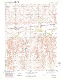
1953 Map of Woodston
USGS Topo · Published 1979About this map
The Woodston townsite sits at the heart of this landscape, positioned along the Missouri Pacific railroad just north of the South Fork Solomon River. This mid-century survey, updated with late-1970s revisions, reveals the community's local infrastructure, including the High Sch and several township subdivisions such as Ash Rock and Lowell. The river valley is a defining corridor, flanked by the Pleasant Valley Sch and Pleasant Valley Cem to the east.
Find a feature on this map
16 named features on this map. Tap any name to fly to it.
Don’t see what you’re looking for? This feature index may not catch every label — zoom into the map to look around manually.
Map Details
Editions of this 1953 Woodston Map
2 editions found
Other maps of this area

1893 · Smith Center
USGS Topo · 1:125,000

1893 · Phillipsburg
USGS Topo · 1:125,000

1896 · Osborne
USGS Topo · 1:125,000

1896 · Plainville
USGS Topo · 1:125,000

1953 · Woodston NW
USGS Topo · 1:24,000

1953 · Woodston
USGS Topo · 1:24,000

1953 · Alton
USGS Topo · 1:24,000

1955 · Beloit
USGS Topo · 1:250,000

1959 · Beloit
USGS Topo · 1:250,000

1961 · Kirwin SE
USGS Topo · 1:24,000