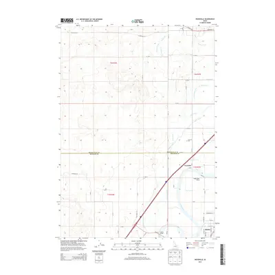
2013 Map of Woodville
USGS Topo · Published 2013About this map
Snake River water rights and agricultural engineering define this portion of the Snake River Valley on the border of Bonneville and Bingham counties. The landscape is dominated by an intricate network of irrigation infrastructure designed to sustain the region's farms, including the Great Western Canal, Oakland Canal, and Woodville Canal. The settlement of Woodville serves as a central point for local history, featuring the Woodville Cem located just north of the county line. To the southeast, the town of Shelley sits near the Shelley Bridge, which provides a vital crossing over the river. The map details how lateral canals like the Olson Lateral and Shull Lateral distribute water through the townships of t2n r36e and t1n r37e, illustrating the complex relationship between the river's flow and the established grid of county roads.
Find a feature on this map
40 named features on this map. Tap any name to fly to it.
Don’t see what you’re looking for? This feature index may not catch every label — zoom into the map to look around manually.
Map Details
Editions of this 2013 Woodville Map
This is the sole edition of this map. No revisions or reprints were ever made.
Other maps of this area

1948 · Woodville
USGS Topo · 1:24,000

1948 · Idaho Falls North
USGS Topo · 1:24,000

1948 · Idaho Falls South
USGS Topo · 1:24,000

1949 · Idaho Falls North
USGS Topo · 1:24,000

1949 · Roberts
USGS Topo · 1:62,500

1949 · Shattuck Butte
USGS Topo · 1:24,000

1950 · Shattuck Butte
USGS Topo · 1:24,000

1950 · Woodville
USGS Topo · 1:24,000

1950 · Idaho Falls South
USGS Topo · 1:24,000

1950 · Goshen
USGS Topo · 1:24,000