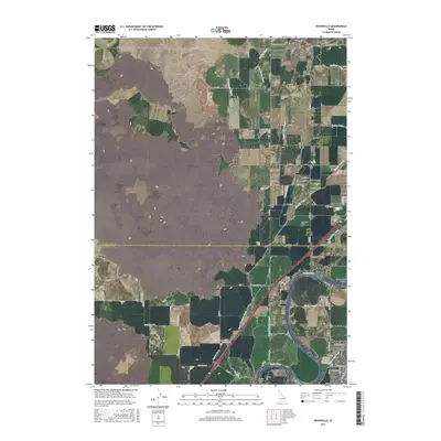
2017 Map of Woodville
USGS Topo · Published 2017About this map
The Snake River carves through this eastern Idaho landscape, defining the southeastern corner of the quadrangle and serving as the primary source for a complex network of irrigation infrastructure. This 2017 edition illustrates the intricate water-management system essential to the region's agricultural character, featuring major arteries like the Great Western Canal, Woodville Canal, and Sidehill Canal. These waterways branch into smaller distributors such as the Capital Hill Lateral and Shull Lateral, which crisscross the territory between Woodville and the Bonneville Co - Bingham Co line.
Find a feature on this map
57 named features on this map. Tap any name to fly to it.
Don’t see what you’re looking for? This feature index may not catch every label — zoom into the map to look around manually.
Map Details
Editions of this 2017 Woodville Map
This is the sole edition of this map. No revisions or reprints were ever made.
Other maps of this area

1948 · Woodville
USGS Topo · 1:24,000

1948 · Idaho Falls North
USGS Topo · 1:24,000

1948 · Idaho Falls South
USGS Topo · 1:24,000

1949 · Idaho Falls North
USGS Topo · 1:24,000

1949 · Roberts
USGS Topo · 1:62,500

1949 · Shattuck Butte
USGS Topo · 1:24,000

1950 · Shattuck Butte
USGS Topo · 1:24,000

1950 · Woodville
USGS Topo · 1:24,000

1950 · Idaho Falls South
USGS Topo · 1:24,000

1950 · Goshen
USGS Topo · 1:24,000