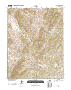
2013 Map of Woodville
USGS Topo · Published 2013About this map
The Hazel River and its many tributaries, including the Hughes River and White Walnut Run, carve through a landscape of prominent peaks such as Bessie Bell Mountain and Slaughter Mountain. This 2013 survey of Rappahannock County highlights a series of historic milling settlements and crossroads that have defined the local economy for generations. Locations like Peola Mills and Slate Mills suggest a legacy of water-powered industry along the riverbanks, while smaller communities like Scrabble, Woodville, and Hawlin are connected by a network of winding roads including Rudasill Mill Rd and Slaughter Ln. The presence of the James H Fletcher Bridge and Jenkins Orchard indicates a blend of engineering and agriculture that sustains this Piedmont community.
Find a feature on this map
101 named features on this map. Tap any name to fly to it.
Don’t see what you’re looking for? This feature index may not catch every label — zoom into the map to look around manually.
Map Details
Editions of this 2013 Woodville Map
This is the sole edition of this map. No revisions or reprints were ever made.
Other maps of this area

1892 · Gordonsville
USGS Topo · 1:125,000

1893 · Luray
USGS Topo · 1:125,000

1905 · Luray
USGS Topo · 1:125,000

1929 · Stony Man
USGS Topo · 1:48,000

1930 · Madison
USGS Topo · 1:48,000

1933 · Stony Man
USGS Topo · 1:62,500

1933 · Madison
USGS Topo · 1:62,500

1949 · Charlottesville
USGS Topo · 1:250,000

1956 · Charlottesville
USGS Topo · 1:250,000

1961 · Sperryville
USGS Topo · 1:62,500