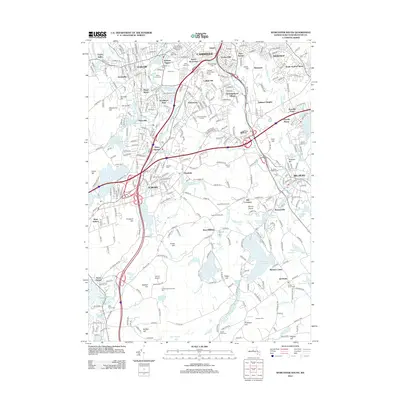
2012 Map of Worcester South
USGS Topo · Published 2012About this map
South Worcester and its surrounding communities are anchored by the prominent campus of the College of the Holy Cross on College Hill. This 2012 topographic record documents the dense urban and suburban fabric of southern Worcester and Auburn, where historic cemeteries like Hope Cem and Notre Dame Cem reflect the long-standing community roots. The landscape is defined by the industrial legacy of the Blackstone River and Middle River, which shaped the development of neighborhoods from Quinsigamond Village to Bramanville. Further south, the terrain transitions into more agricultural and wooded parcels, featuring Stowe Farm Orchard and Hawk Hill Orchards near West Millbury. The presence of the Oxford Airport and the complex interchange of the B & A RR underscore the area's role as a regional transportation hub during the early 21st century.
Find a feature on this map
99 named features on this map. Tap any name to fly to it.
Don’t see what you’re looking for? This feature index may not catch every label — zoom into the map to look around manually.
Map Details
Editions of this 2012 Worcester South Map
This is the sole edition of this map. No revisions or reprints were ever made.
Other maps of this area

1885 · Worcester
USGS Topo · 1:62,500

1886 · Worcester
USGS Topo · 1:62,500

1886 · Blackstone
USGS Topo · 1:62,500

1887 · Marlboro
USGS Topo · 1:62,500

1889 · Marlboro
USGS Topo · 1:62,500

1889 · Blackstone
USGS Topo · 1:62,500

1889 · Webster
USGS Topo · 1:62,500

1892 · Webster
USGS Topo · 1:62,500

1892 · Worcester
USGS Topo · 1:62,500

1893 · Blackstone
USGS Topo · 1:62,500