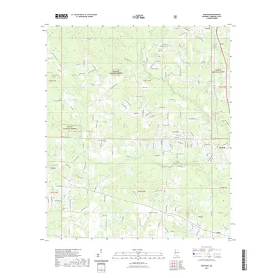
2021 Map of Wortham
USGS Topo · Published 2021About this map
De Soto National Forest dominates the piney woods landscape of Harrison County, where the Biloxi River and the Little Biloxi River carve through the coastal plain. This recent survey captures the rural character of communities like Wortham, Lizana, and Lyman as they exist today. Family histories are anchored here by several established grounds, including Wedgeworth Cem, Dye Cem, and Finley Cem. The map reveals a dense network of timber and access roads, such as Saucier Lizana Rd and Saucier Advance Rd, which connect the scattered homesteads and small settlements. The drainage patterns of Hickory Cr and Honey Br illustrate the hydrologic complexity of this watershed, which eventually feeds south toward Bayou Bernard.
Find a feature on this map
134 named features on this map. Tap any name to fly to it.
Don’t see what you’re looking for? This feature index may not catch every label — zoom into the map to look around manually.
Map Details
Editions of this 2021 Wortham Map
This is the sole edition of this map. No revisions or reprints were ever made.
Other maps of this area

1953 · Mobile
USGS Topo · 1:250,000

1954 · McHenry
USGS Topo · 1:62,500

1954 · Gulfport North
USGS Topo · 1:24,000

1955 · Savannah
USGS Topo · 1:62,500

1956 · Vidalia
USGS Topo · 1:24,000

1956 · Gulfport NW
USGS Topo · 1:24,000

1957 · Mobile
USGS Topo · 1:250,000

1960 · Mobile
USGS Topo · 1:250,000

1963 · Mobile
USGS Topo · 1:250,000

1965 · Mobile
USGS Topo · 1:250,000