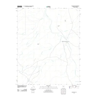
2011 Map of Wupatki SE
USGS Topo · Published 2011About this map
Black Falls Crossing serves as a focal point for this 2011 survey, marking a significant transition where the Little Colorado River winds through high desert terrain. The landscape is defined by an intricate network of drainage systems, including Deadman Wash, Citadel Wash, and Antelope Wash, which converge toward the river valley. In the northern reaches, the striking elevations of Tse Lichii Point and the archaeological resonance of Inscription Point rise above the surrounding Wupatki Basin. This document preserves the modern placement of vital water sources in an arid environment, from the reliable Heiser Spring to various catchment areas such as Trader Tank and Aswan Tank. The geography suggests a space where natural landforms dictated movement, seen in the paths through Kanaa Valley and along the banks of the Black Falls.
Find a feature on this map
19 named features on this map. Tap any name to fly to it.
Don’t see what you’re looking for? This feature index may not catch every label — zoom into the map to look around manually.
Map Details
Editions of this 2011 Wupatki SE Map
This is the sole edition of this map. No revisions or reprints were ever made.
Other maps of this area

1886 · San Francisco Mtns
USGS Topo · 1:250,000

1891 · San Francisco Mtns
USGS Topo · 1:250,000

1894 · San Francisco Mtns
USGS Topo · 1:250,000

1899 · San Francisco Mtns
USGS Topo · 1:250,000

1947 · Flagstaff
USGS Topo · 1:250,000

1954 · Flagstaff
USGS Topo · 1:250,000

1955 · Black Falls 4 SW
USGS Topo · 1:24,000

1955 · Black Falls NE
USGS Topo · 1:24,000

1958 · Flagstaff
USGS Topo · 1:250,000

1960 · Flagstaff
USGS Topo · 1:250,000