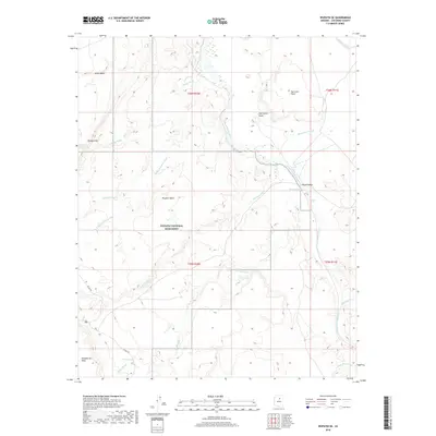
2018 Map of Wupatki SE
USGS Topo · Published 2018About this map
Wupatki National Monument dominates this high-desert landscape in Coconino County, where the topography is defined by ancient volcanic activity and the winding course of the Little Colorado River. This 2018 survey detail shows a network of named washes, such as Citadel Wash and Deadman Wash, which carve through the arid terrain between prominent landforms like Woodhouse Mesa and the Doney Cliffs. Cultural and geological markers such as Inscription Point and Tse Lichii Point suggest a long human presence in this environment, further evidenced by the secluded Heiser Spring. The map captures the interface between the monument's protected grounds and the surrounding open territory near Black Falls, providing a modern record of the access roads like Co RD 395 that traverse the Wupatki Basin.
Find a feature on this map
26 named features on this map. Tap any name to fly to it.
Don’t see what you’re looking for? This feature index may not catch every label — zoom into the map to look around manually.
Map Details
Editions of this 2018 Wupatki SE Map
This is the sole edition of this map. No revisions or reprints were ever made.
Other maps of this area

1886 · San Francisco Mtns
USGS Topo · 1:250,000

1891 · San Francisco Mtns
USGS Topo · 1:250,000

1894 · San Francisco Mtns
USGS Topo · 1:250,000

1899 · San Francisco Mtns
USGS Topo · 1:250,000

1947 · Flagstaff
USGS Topo · 1:250,000

1954 · Flagstaff
USGS Topo · 1:250,000

1955 · Black Falls 4 SW
USGS Topo · 1:24,000

1955 · Black Falls NE
USGS Topo · 1:24,000

1958 · Flagstaff
USGS Topo · 1:250,000

1960 · Flagstaff
USGS Topo · 1:250,000