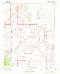
1969 Map of Wupatki SE
USGS Topo · Published 1972About this map
Wupatki National Monument and the bordering Navajo Indian Reservation meet along the winding path of the Little Colorado River in this 1960s survey. The landscape is a high-desert archaeology site, prominently featuring numerous ancient dwellings such as Wukoki Ruin and the Citadel, alongside modern administration at Wupatki Monument Hdqrs. The area's dependence on scarce water sources is evident through named features like Heiser Spring, Savage Well, and Black Falls Crossing.
Find a feature on this map
32 named features on this map. Tap any name to fly to it.
Don’t see what you’re looking for? This feature index may not catch every label — zoom into the map to look around manually.
Map Details
Editions of this 1969 Wupatki SE Map
This is the sole edition of this map. No revisions or reprints were ever made.
Other maps of this area

1886 · San Francisco Mtns
USGS Topo · 1:250,000

1891 · San Francisco Mtns
USGS Topo · 1:250,000

1894 · San Francisco Mtns
USGS Topo · 1:250,000

1899 · San Francisco Mtns
USGS Topo · 1:250,000

1947 · Flagstaff
USGS Topo · 1:250,000

1954 · Flagstaff
USGS Topo · 1:250,000

1955 · Black Falls 4 SW
USGS Topo · 1:24,000

1955 · Black Falls NE
USGS Topo · 1:24,000

1958 · Flagstaff
USGS Topo · 1:250,000

1960 · Flagstaff
USGS Topo · 1:250,000