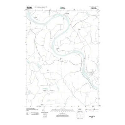
2010 Map of Wyalusing
USGS Topo · Published 2010About this map
The Susquehanna River carves a dramatic oxbow through this section of Bradford County, defining a landscape steeped in local heritage. This river bend is home to the French Azilum and the French Azilum Overlook, sites established as a refuge for French exiles in the late 18th century. Nearby, the settlement of Asylum and the crossing at Homets Ferry underscore the historic importance of the river for transport and commerce. To the south, the borough of Wyalusing sits at the confluence where the river meets local tributaries.
Find a feature on this map
84 named features on this map. Tap any name to fly to it.
Don’t see what you’re looking for? This feature index may not catch every label — zoom into the map to look around manually.
Map Details
Editions of this 2010 Wyalusing Map
This is the sole edition of this map. No revisions or reprints were ever made.
Other maps of this area

1923 · Towanda
USGS Topo · 1:62,500

1926 · Towanda
USGS Topo · 1:62,500

1943 · Towanda
USGS Topo · 1:62,500

1943 · Monroeton
USGS Topo · 1:62,500

1943 · Le Raysville
USGS Topo · 1:62,500

1945 · Le Raysville
USGS Topo · 1:62,500

1945 · Meshoppen
USGS Topo · 1:62,500

1945 · Jenningsville
USGS Topo · 1:24,000

1945 · Laceyville
USGS Topo · 1:24,000

1947 · Jenningsville
USGS Topo · 1:31,680
Featured Places
- Wilmot Township, PA
- Asylum Township, PA
- Standing Stone Township, PA
- Wyalusing, PA
- Terrytown, Terry Township