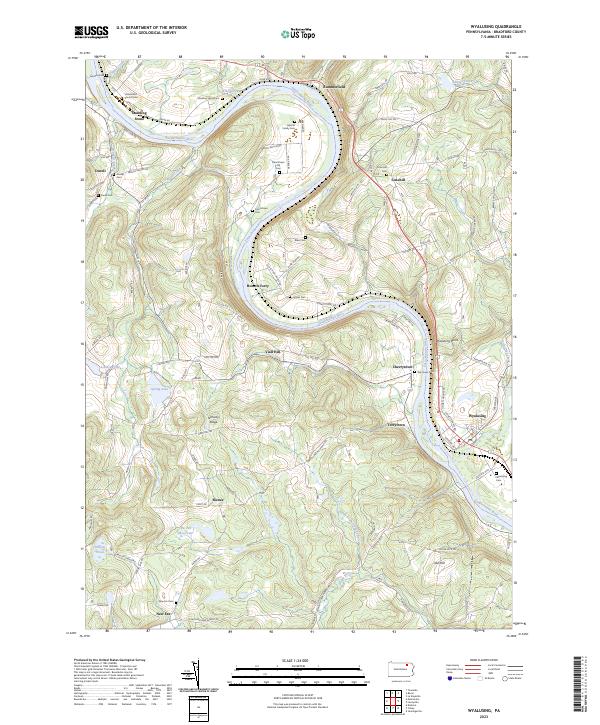
2023 Map of Wyalusing
USGS Topo · Published 2023About this map
The Susquehanna River carves a winding path through this Bradford County landscape, defining the character of river-valley life. Settlement patterns follow the water, with Standing Stone, Homets Ferry, and Terrytown anchoring the banks. The map is particularly rich for genealogical research, documenting numerous small burial grounds including the Laporte Family Cem, Frenchtown Old Cem, and the Universalist Church Cem. These sites, along with family-named landmarks like Viall Hill and Oak Hill, speak to generations of rural farming and river trade.
Find a feature on this map
104 named features on this map. Tap any name to fly to it.
Don’t see what you’re looking for? This feature index may not catch every label — zoom into the map to look around manually.
Map Details
Editions of this 2023 Wyalusing Map
This is the sole edition of this map. No revisions or reprints were ever made.
Other maps of this area

1923 · Towanda
USGS Topo · 1:62,500

1926 · Towanda
USGS Topo · 1:62,500

1943 · Towanda
USGS Topo · 1:62,500

1943 · Monroeton
USGS Topo · 1:62,500

1943 · Le Raysville
USGS Topo · 1:62,500

1945 · Le Raysville
USGS Topo · 1:62,500

1945 · Meshoppen
USGS Topo · 1:62,500

1945 · Jenningsville
USGS Topo · 1:24,000

1945 · Laceyville
USGS Topo · 1:24,000

1947 · Jenningsville
USGS Topo · 1:31,680