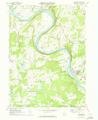
1969 Map of Wyalusing
USGS Topo · Published 1973About this map
The Susquehanna River carves a dramatic S-curve through Bradford County in this late 1960s survey, dictating the settlement patterns of towns like Wyalusing and Asylum. The Lehigh Valley railroad tracks trace the river's eastern bank, linking riverfront hamlets such as Rummerfield and Homets Ferry. This area's history is deeply intertwined with these transportation corridors and the high ground overlooking them, including the prominent Wyalusing Rocks and Viall Hill.
Find a feature on this map
47 named features on this map. Tap any name to fly to it.
Don’t see what you’re looking for? This feature index may not catch every label — zoom into the map to look around manually.
Map Details
Editions of this 1969 Wyalusing Map
This is the sole edition of this map. No revisions or reprints were ever made.
Other maps of this area

1923 · Towanda
USGS Topo · 1:62,500

1926 · Towanda
USGS Topo · 1:62,500

1943 · Towanda
USGS Topo · 1:62,500

1943 · Monroeton
USGS Topo · 1:62,500

1943 · Le Raysville
USGS Topo · 1:62,500

1945 · Le Raysville
USGS Topo · 1:62,500

1945 · Meshoppen
USGS Topo · 1:62,500

1945 · Jenningsville
USGS Topo · 1:24,000

1945 · Laceyville
USGS Topo · 1:24,000

1947 · Jenningsville
USGS Topo · 1:31,680