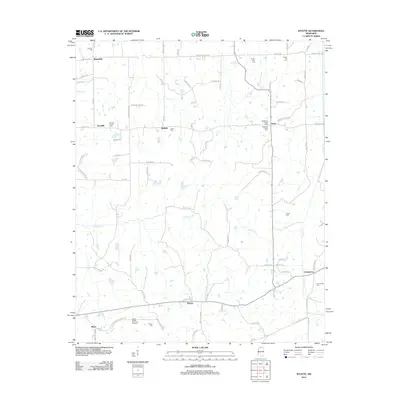
2012 Map of Wyatte
USGS Topo · Published 2012About this map
Wyatte and Chulahoma anchor this rural Mississippi landscape, where a dense network of local roads connects scattered settlements and historic family burial grounds. The terrain is defined by the drainage basins of Hickahala Cr and Cuffawa Cr, which meander through the countryside south of the Tennessee border. Genealogists and local historians will find significant detail in the numerous cemeteries that dot the map, including Harmon Cem near Wakefield and Grubb Hill Cem in the northeast. The presence of Carter Sunset Memorial Gardens near Aiken contrasts with older church-affiliated sites like Roberts Chapel Cem. These points of interest, joined by routes such as Old Senatobia Chulahoma Rd and Thyatira Tyro Rd, reveal the long-standing community structure of northern Mississippi.
Find a feature on this map
87 named features on this map. Tap any name to fly to it.
Don’t see what you’re looking for? This feature index may not catch every label — zoom into the map to look around manually.
Map Details
Editions of this 2012 Wyatte Map
This is the sole edition of this map. No revisions or reprints were ever made.
Other maps of this area

1944 · Senatobia
USGS Topo · 1:62,500

1944 · Hernando
USGS Topo · 1:62,500

1944 · Tyro
USGS Topo · 1:62,500

1948 · Byhalia
USGS Topo · 1:62,500

1956 · Tupelo
USGS Topo · 1:250,000

1958 · Tupelo
USGS Topo · 1:250,000
1971 · Byhalia
USGS Topo · 1:24,000
1971 · Marianna
USGS Topo · 1:24,000

1971 · Wyatte
USGS Topo · 1:24,000

1971 · Laws Hill
USGS Topo · 1:24,000