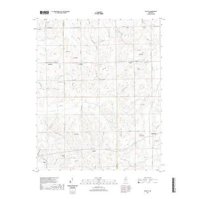
2021 Map of Wyatte
USGS Topo · Published 2021About this map
Hickahala Cr and Cuffawa Creek drain the undulating landscape of northern Mississippi, where the boundaries of Tate and Marshall counties meet. This 2021 survey details a predominantly rural territory characterized by family-named settlements and historical burial grounds. Small communities such as Wakefield, Wallhill, and Wyatte are linked by a network of local roads like Tate Marshall Rd and Wakefield Rd, reflecting a long-standing agricultural and residential pattern. Numerous sites of genealogical interest are documented across the townships, including Harmon Cem, Shady Grove Cem, and Carter Sunset Memorial Gardens. The landscape is further defined by geographic features such as Sanders Cove and Marshall Cove, which punctuate the terrain between the dispersed homesteads of Rockhill and Orion.
Find a feature on this map
116 named features on this map. Tap any name to fly to it.
Don’t see what you’re looking for? This feature index may not catch every label — zoom into the map to look around manually.
Map Details
Editions of this 2021 Wyatte Map
This is the sole edition of this map. No revisions or reprints were ever made.
Other maps of this area

1944 · Senatobia
USGS Topo · 1:62,500

1944 · Hernando
USGS Topo · 1:62,500

1944 · Tyro
USGS Topo · 1:62,500

1948 · Byhalia
USGS Topo · 1:62,500

1956 · Tupelo
USGS Topo · 1:250,000

1958 · Tupelo
USGS Topo · 1:250,000
1971 · Byhalia
USGS Topo · 1:24,000
1971 · Marianna
USGS Topo · 1:24,000

1971 · Wyatte
USGS Topo · 1:24,000

1971 · Laws Hill
USGS Topo · 1:24,000