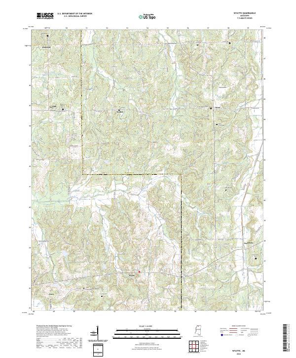
2024 Map of Wyatte
USGS Topo · Published 2024About this map
Wakefield and Wallhill anchor this rural landscape in Marshall and Tate counties, where the terrain is defined by a dense network of creek drainages. Significant watercourses like Hickahala Creek, Bad Branch Creek, and Cuffawa Creek carve through the countryside, influencing the placement of early settlements and family homesteads. The map reveals a high density of small cemeteries and community focal points, such as Roberts Chapel and Sunset Memorial Garden near Aiken.
Find a feature on this map
84 named features on this map. Tap any name to fly to it.
Don’t see what you’re looking for? This feature index may not catch every label — zoom into the map to look around manually.
Map Details
Editions of this 2024 Wyatte Map
This is the sole edition of this map. No revisions or reprints were ever made.
Other maps of this area

1944 · Senatobia
USGS Topo · 1:62,500

1944 · Hernando
USGS Topo · 1:62,500

1944 · Tyro
USGS Topo · 1:62,500

1948 · Byhalia
USGS Topo · 1:62,500

1956 · Tupelo
USGS Topo · 1:250,000

1958 · Tupelo
USGS Topo · 1:250,000
1971 · Byhalia
USGS Topo · 1:24,000
1971 · Marianna
USGS Topo · 1:24,000

1971 · Wyatte
USGS Topo · 1:24,000

1971 · Laws Hill
USGS Topo · 1:24,000