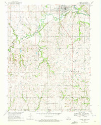
1970 Map of Wymore
USGS Topo · Published 1972About this map
Wymore sits at the northern edge of this landscape, positioned along the banks of the Big Blue River where it meets Indian Creek. This 1970 survey illustrates a critical rail junction where the Burlington Northern and Union Pacific lines intersect, underscoring the town's importance as a regional transportation hub near the Nebraska-Kansas border. A notable historic feature is the Old Indian Treaty Boundary, which cuts diagonally across the northern townships of Sicily and Wymore. The map records several rural burial grounds essential for genealogical research, including Bethel Cem and St Johns Cem in Barneston township, and Immanuel Cem further south. The terrain transitions from the river valley into the rolling hills of Paddock township, where the small settlement of Krider is located along the rail line.
Find a feature on this map
22 named features on this map. Tap any name to fly to it.
Don’t see what you’re looking for? This feature index may not catch every label — zoom into the map to look around manually.
Map Details
Editions of this 1970 Wymore Map
This is the sole edition of this map. No revisions or reprints were ever made.
Other maps of this area

1889 · Marysville
USGS Topo · 1:125,000

1894 · Marysville
USGS Topo · 1:125,000

1955 · Manhattan
USGS Topo · 1:250,000

1955 · Lincoln
USGS Topo · 1:250,000

1956 · Manhattan
USGS Topo · 1:250,000

1957 · Manhattan
USGS Topo · 1:250,000

1957 · Lincoln
USGS Topo · 1:250,000

1958 · Lincoln
USGS Topo · 1:250,000

1964 · Blue Springs
USGS Topo · 1:24,000

1966 · Oketo
USGS Topo · 1:24,000